My Wisconsin Space

Wisconsin Campgrounds, Wisconsin State Parks, National Parks and Monuments, Sacred Spaces

  • Home
  • A-Z List
  • Coffee Houses
  • Park & Campsite Videos
  • About
  • Home
  • A-Z List
  • Coffee Houses
  • Park & Campsite Videos
  • About

No Widgets found in the Sidebar Alt!

  • Ancient Peoples,  Other States,  Picture of the Day

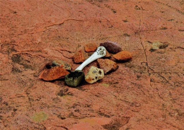
    Ceremonial Artifacts, Jeffers Petroglyphs – Comfrey, Minnesota

    September 20, 2014 /

    Ceremonial Artifacts, Jeffers Petroglyphs
    ©2014 John Wanserski for Creative Juice LLC

    Jeffers Petroglyphs

    History of the Jeffers Petroglyphs

    Sioux Quartzite (Wikipedia entry)

    Overview of Iowa and Otoe genealogy

    Weather forecast for Comfrey, Minnesota vicinity

    Blog entries for Jeffers Petroglyphs

    Videos of other parks, A-Z List , Locator Map

    Share on FacebookShare on Facebook

    read more
    Traveler John 0 Comments
  • Maps,  WI Maps

    Map of Native American Reservations in Wisconsin

    July 17, 2011 /

    Native American Tribes in Wisconsin

    Native American Tourism of Wisconsin

    Indians in the 20th Century (Wisconsin Historical Society)

    Great Lakes Indian Fish and Wildlife Commission (GLIFWC)

    Free Trail Maps and Guides from the Wisconsin Department of Tourism

    Wisconsin maps at the Wisconsin State Cartographer’s site

    USGS Store for topographic maps and other maps

    Blog entries for Wisconsin maps

    Videos of other parks, A-Z List , Locator Map

    Share on FacebookShare on Facebook

    read more
    Traveler John 2 Comments
  • Ancient Peoples,  Nat. Park/Forests,  Videos

    Video of the Indian Arts Museum, Colter Bay Visitor Center – Grand Tetons National Park, Wyoming

    October 1, 2010 /


    ©2010 John Wanserski for Creative Juice LLC
    The Tetons first received government protection in 1897 when Congress created the Teton Forest Reserve. In 1929, the central peaks of the Teton Range and a half dozen lakes at their base officially became Grand Teton National Park. By 1950 the original 1929 park was united with the 1943 Jackson Hole National Monument to create the present day 485 square mile park. The Tetons, rising abruptly from the floor of the Snake River Valley, are fault block mountains with their origin about 13 million years ago. Elk and pronghorn antelope make annual migrations through the park. Moose are seen around the Snake River wetlands and mountain lakes. Black bear and grizzlies roam the mountain slopes and wooded lake shores. The park has five campgrounds and 200 miles of trails to explore. The Colter Bay Visitor Center houses the Indian Arts Museum.

    Grand Tetons National Park

    Map of Grand Tetons National Park (PDF file)

    Colter Bay Visitor Center at Grand Tetons National Park

    Grand Tetons National Park blog postings

    Weather forecast for Grand Tetons National Park vicinity

    Videos of other parks, A-Z List , Locator Map

    Share on FacebookShare on Facebook

    read more
    Traveler John 0 Comments
  • Ancient Peoples,  Picture of the Day,  Wisconsin

    Ojibwe Museum and Cultural Center – Lac du Flambeau, Wisconsin

    September 24, 2010 /


    ©2010 John Wanserski for Creative Juice LLC
    George W. Brown, Jr. Ojibwe Museum and Cultural Center

    Waswagoning Re-Created Ojibwe Indian Village

    History of Lac du Flambeau

    Lac du Flambeau Band of Lake Superior Chippewa (Wikipedia entry)

    Weather forecast for Lac du Flambeau, Wisconsin vicinity

    Blog entries for Ojibwe Museum and Cultural Center

    Videos of other parks, A-Z List , Locator Map

    Share on FacebookShare on Facebook

    read more
    Traveler John 0 Comments
  • Ancient Peoples,  Picture of the Day,  Wisconsin

    Fish Decoys, Ojibwe Museum and Cultural Center – Lac du Flambeau, Wisconsin

    September 23, 2010 /


    ©2010 John Wanserski for Creative Juice LLC
    George W. Brown, Jr. Ojibwe Museum and Cultural Center

    Ojibwe Winter Spearfishing Decoy

    History of Lac du Flambeau

    Lac du Flambeau Band of Lake Superior Chippewa (Wikipedia entry)

    Weather forecast for Lac du Flambeau, Wisconsin vicinity

    Blog entries for Ojibwe Museum and Cultural Center

    Videos of other parks, A-Z List , Locator Map

    Share on FacebookShare on Facebook

    read more
    Traveler John 0 Comments
  • Ancient Peoples,  Picture of the Day,  Wisconsin

    Ancient Canoe, Ojibwe Museum and Cultural Center – Lac du Flambeau, Wisconsin

    September 22, 2010 /


    ©2010 John Wanserski for Creative Juice LLC
    George W. Brown, Jr. Ojibwe Museum and Cultural Center

    History of Lac du Flambeau

    Lac du Flambeau Band of Lake Superior Chippewa (Wikipedia entry)

    Weather forecast for Lac du Flambeau, Wisconsin vicinity

    Blog entries for Ojibwe Museum and Cultural Center

    Videos of other parks, A-Z List , Locator Map

    Share on FacebookShare on Facebook

    read more
    Traveler John 0 Comments
  • Nat. Park/Forest,  Picture of the Day

    Wind Circle by Junkyo Muto at Devil’s Tower National Monument, Wyoming

    December 25, 2008 /

    Devil’s Tower National Monument

    Tribal Connections site at Devil’s Tower National Monument

    Blog entries for Devil’s Tower National Monument

    IPod videos of other parks, A-Z List , Locator Map

    Share on FacebookShare on Facebook

    read more
    Traveler John 0 Comments

Random Entry

Allen Lake at Dusk, Hartman Creek State Park - Waupaca, Wisconsin

Created By Bunk Beds

Purchase Prints of My Sacred Spaces

Art Prints

Wisconsin Books

Categories

  • Ancient Peoples (292)
    • Cliff Dwellings (141)
    • Mound Builders (36)
  • Books (16)
  • Campsites (176)
    • .Wisconsin Sites (135)
    • Other Sites (41)
    • Walk-In Sites (29)
    • Water Access (40)
  • Coffee Houses (699)
    • Madison Coffee (135)
    • Other Coffee (228)
    • WI Coffee (471)
  • Maps (174)
    • Other Maps (49)
    • WI Maps (125)
  • Picture of the Day (5,878)
    • Kaleidoscope (205)
    • Kayak Waters (1,129)
    • Nat. Park/Forest (1,338)
    • Other States (2,893)
    • Wisconsin (2,808)
  • Videos (150)
    • Campgrounds (92)
    • County Parks (6)
    • Nat. Park/Forests (28)
    • Other Places (7)
    • State Forest (27)
    • State Park (81)
    • Trails (20)

+ WI Earth Links

  • – WI State Parks
  • Aldo Leopold Foundation
  • Aldo Leopold Legacy Trails
  • Apostle Islands
  • BirdCast
  • Botanical Club of WI
  • Chequamegon-Nicolet
  • Creative Juice LLC
  • Daycreek.com
  • Discover Wisconsin
  • Door County Land Trust
  • Earth Spaces – YouTube
  • Earthspace Twitter
  • Fishing Forecast
  • Friends of WI State Parks
  • Gathering Waters
  • Gaylord Nelson Wilderness
  • Glacial Lakes Conservancy
  • GLIFWC
  • Great Lakes Forever
  • Great Lakes Maps
  • Great Lakes Nautical Charts
  • Great Lakes Waterfalls
  • Ice Age Trail
  • Ice Age Trail Alliance
  • Kickapoo Valley Preserve
  • Lake Michigan Water Trail
  • Lakeland Aerial Photo
  • Lower WI Riverway
  • Mississippi River Charts
  • Mississippi River Trail
  • Native Am. Tourism of WI
  • Natural Heritage Land Trust
  • Nelson Institute
  • Olbrich Botanical Gardens
  • Prairie Enthusiasts
  • River Alliance of WI
  • Sigurd Olson Environ. Inst.
  • St. Croix Scenic Riverway
  • Teardrop Campers
  • The High Ground
  • Travel Green Wisconsin
  • Travel Wisconsin.com
  • Trees of Wisconsin
  • Troy Gardens
  • UW Arboretum
  • UW Press
  • UW Press WI Books
  • UW Sea Grant Institute
  • Wendt Library
  • WGNHS
  • WI Academy
  • WI Beach Health
  • WI Bear
  • WI Bike Trails
  • WI Bird Conservation
  • WI Birding & Nature Trails
  • WI Blue Book
  • WI Campion Trees
  • WI Canoe Heritage Museum
  • WI Coastal Atlas
  • WI Cougar Sightings
  • WI County Forests
  • WI County Parks
  • WI Covered Bridges
  • WI Dark Sky Sites
  • WI DNR Maps
  • WI Elk Herd
  • WI Endangered Resources
  • WI Fall Color Report
  • WI Fishing
  • WI Geography & Climate
  • WI Historic Sites
  • WI Historical Markers
  • WI HomeTownLocator
  • WI Horse Trails
  • WI Indian Mounds
  • WI Lake Maps
  • WI Land Trusts
  • WI Magazine of History
  • WI Maritime Trails
  • WI Minerals Database
  • WI Museums
  • WI Nat. Hist. Landmarks
  • WI Nat. Natural Landmarks
  • WI Nat. Res. Foundation
  • WI Nat. Wildlife Refuges
  • WI Natural Areas
  • WI Natural Resources Mag
  • WI Nature Conservancy
  • WI North Country Trail
  • WI Record Fish
  • WI Recreation Trails
  • WI Rustic Roads
  • WI Scenic Byways
  • WI Shipwrecks
  • WI Snow Report
  • WI State Cartographer
  • WI State Climatology Office
  • WI State Herbarium
  • WI State Historical Society
  • WI State Wildlife Areas
  • WI Statistics
  • WI Turkeys
  • WI Water
  • WI Water Trails
  • WI Weather
  • WI Wetlands Association
  • WI Wilderness
  • WI Wolves
  • WisconsinView
  • WOJB Radio

~ Earth Links

  • America's Quietist Routes
  • Backroads
  • Ctr for Sustainable Destinations
  • Daycreek.com
  • Earth Porn
  • Earthspace Twitter
  • Fishing Forecast
  • Google NGram Viewer
  • Historical Marker Database
  • iLike
  • Intern’l Dark Sky Assn.
  • LandScope America
  • Live Music Archive
  • Mississippi River Trail
  • NASA Earth Observatory
  • Nat. Hist. Landmarks
  • Nat. Register of Hist. Places
  • National Geographic Soc.
  • National Map
  • National Park Maps
  • National Park Service
  • National Parks (PBS TV)
  • National Parks Traveler
  • National Recreation Trails
  • National Scenic Byways
  • National Trails System
  • Native Tourism
  • Nature Conservancy
  • NatureServe
  • Nelson Institute
  • North Country Trail
  • Photosynth
  • Picture Gallery
  • Ramsar List of Wetlands
  • S. Arizona Nonprofits
  • Search-Cube
  • Shades of Rez
  • Shelfari
  • SoundCloud
  • TouchGraph
  • TrailLink
  • Treehugger
  • U.S. Forest Service
  • US Home Town Locator
  • USGS Store
  • Weather Channel
  • Wilderness Institute
  • Wilderness Volunteers
  • WiserEarth

Tags

Animals Architecture Arizona Art Beach campsite Canyon Capital Springs Chippewa County Chippewa Moraine Clouds Coffee House County Park Creek Dane County Park Desert Evening Twilight Hiking Trail Inside Seating Kaleidoscope Lake Madison WI map Morning Twilight Mountains National Forest National Monument National Park New Mexico River Shore Sonoran Desert State Forest State Recreation Area Stream Sunset Texas Trees Twilight Utah Vermont Waterfalls Wildflowers Wildlife Wisconsin Coffee House

Archives

Ashe Theme by WP Royal.