-
Little Girl Point at Oronto Bay, Lake Superior – Gogebic County, Michigan

©2011 John Wanserski for Creative Juice LLCIronwood Township, Gogebic County, Michigan
Nautical Chart of Little Girl Point vicinity (on left)
Blog entries for Lake Superior
Weather forecast for Saxon, Wisconsin and nearby Ironwood Township, Michigan vicinity
-
Oronto Bay with Marble Point in Background, Lake Superior – Ashland County, Wisconsin
-
Victorian Cottage – Bay View, Michigan
©2009 John Wanserski for Creative Juice LLC
Bay View, National Historic LandmarkBay View, Michigan (Wikipedia entry)
Blog entries for Bay View, Michigan
-
View from Scoville Trail – Isle Royale National Park, Michigan
©2009 John Wanserski for Creative Juice LLC
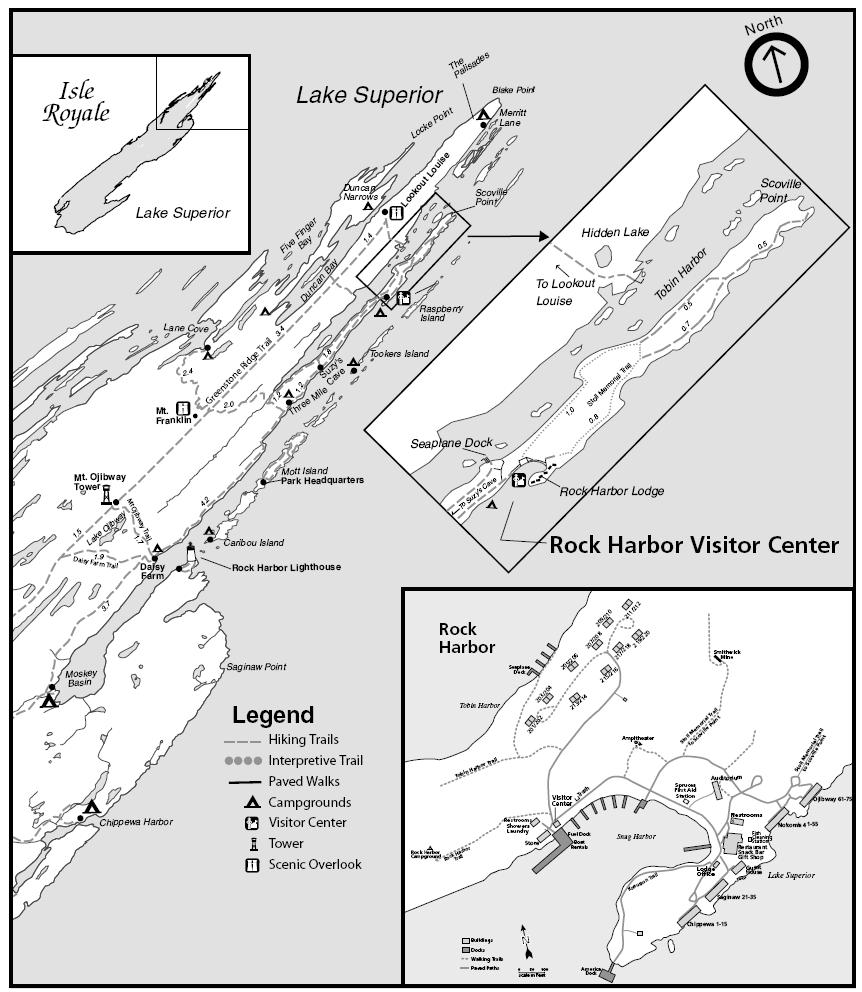
Isle Royale National ParkMap of Isle Royale National Park (PDF file)
Rock Harbor area guide (see trails on page 2)
Blog entries for Isle Royale National Park
Weather forecast for Copper Harbor, Michigan vicinity
-
Sunset over Tobin Harbor – Isle Royale National Park, Michigan
-
Prehistoric Copper Mine – Isle Royale National Park, Michigan
©2009 John Wanserski for Creative Juice LLC
Isle Royale National ParkIsle Royale geology and history
Copper Harbor, gateway to Isle Royale National Park
Map of Isle Royale National Park (PDF file)
Blog entries for Isle Royale National Park
Weather forecast for Copper Harbor, Michigan vicinity
-
Fox at Rock Harbor – Isle Royale National Park, Michigan
©2009 John Wanserski for Creative Juice LLC
Isle Royale National ParkFood Habits of the Red Fox in Isle Royale National Park (JSTOR abstract)
Map of Isle Royale National Park (PDF file)
Blog entries for Isle Royale National Park
Weather forecast for Copper Harbor, Michigan vicinity
-
Topographic Map of Rock Harbor – Isle Royale National Park, Michigan
