My Wisconsin Space

Wisconsin Campgrounds, Wisconsin State Parks, National Parks and Monuments, Sacred Spaces

  • Home
  • A-Z List
  • Coffee Houses
  • Park & Campsite Videos
  • About
  • Home
  • A-Z List
  • Coffee Houses
  • Park & Campsite Videos
  • About

No Widgets found in the Sidebar Alt!

  • Maps,  Other Maps

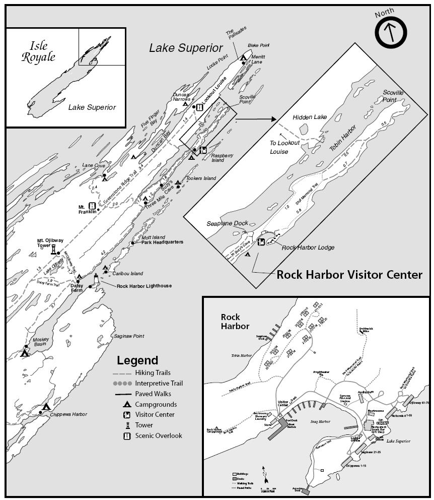
    Topographic Map of Rock Harbor – Isle Royale National Park, Michigan

    January 3, 2010 /

    Isle Royale National Park

    Topographic map downloads from the USGS Store

    Map of Isle Royale National Park (PDF file)

    Rock Harbor area map

    Blog entries for Isle Royale National Park

    Weather forecast for Copper Harbor, Michigan vicinity

    Videos of other parks, A-Z List , Locator Map

    Share on FacebookShare on Facebook

    read more
    Traveler John 0 Comments
  • Picture of the Day,  Wisconsin

    Nautical Chart of Approximate Location of the Christmas Tree Ship, Schooner Rouse Simmons – Two Rivers, Wisconsin

    December 26, 2009 /


    (Note: The red circle on chart is NOT accurate. The remains of the Rouse Simmons were found in 1971 by Milwaukee diver Kent Bellrichard who discovered the vessel’s remains in 165 feet of water 12 miles northeast of Two Rivers, Wisconsin.)

    The Tale of the Christmas Tree Ship (Wisconsin State Historical Society)

    Vessel Detail Information for the Rouse Simmons

    Wisconsin’s Maritime Trails

    Point Beach State Forest

    NOAA Nautical Chart 14903: Algoma to Sheboygan; Kewaunee; Two Rivers

    Great Lakes Nautical Charts

    Map of Point Beach State Forest

    IPod videos of other parks, A-Z List , Locator Map

    Share on FacebookShare on Facebook

    read more
    Traveler John 2 Comments
  • Maps,  WI Maps

    Topographic Map of Gibraltar Rock – Lodi, Wisconsin

    December 19, 2009 /


    Gibraltar Rock State Natural Area

    Topographic maps downloaded from USGS Store

    Lodi, Wisconsin

    Lodi, Wisconsin (Wikipedia entry)

    Lake Wisconsin Chamber of Commerce

    Blog entries for Gibraltar Rock

    IPod videos of other parks, A-Z List , Locator Map

    Share on FacebookShare on Facebook

    read more
    Traveler John 0 Comments
  • Maps,  WI Maps

    Map of Wisconsin’s Notable Features

    December 14, 2009 /


    Source: Wisconsin State Cartographer’s Office

    Wisconsin State Cartographer’s Office

    Highlights of Wisconsin Geography and Climate (Wisconsin Blue Book entry)

    Wisconsin Geological and National History Survey

    Sample Maps of Wisconsin at the Wisconsin Geological and Natural History Survey

    IPod videos of other parks, A-Z List , Locator Map

    Share on FacebookShare on Facebook

    read more
    Traveler John 0 Comments
  • Maps,  Other Maps

    Orthophoto Map of the Deerfield River and Shelburne Falls, Massachusetts

    December 6, 2009 /


    Bridge of Flowers circled in red.

    Shelburne Falls, Massachusetts (Wikipedia entry)

    Mohawk Trail

    Parks and forests in western Massachusetts

    Topographic maps from USGS Store

    Blog entries for Bridge of Flowers

    IPod videos of other parks, A-Z List , Locator Map

    Share on FacebookShare on Facebook

    read more
    Traveler John 0 Comments
  • Maps,  WI Maps

    Topographic Map of Lakes Along the Escanaba Trail, Northern Highlands-American Legion State Forest – Boulder Junction, Wisconsin

    November 28, 2009 /

    Northern Highland-American Legion State Forest

    Topographic maps downloaded from USGS Store

    WisconsinView; Coordinating Remote Sensing Imagery Access and Use in Wisconsin

    Maps of the Northern Highland-American Legion State Forest

    Trail Guide for the Northern Highland-American Legion State Forest (Escanaba Trail p.16)

    Blog entries for the Escanaba Trail

    Blog entries for the Northern Highland-American Legions State Forest

    IPod videos of other parks, A-Z List , Locator Map

    Share on FacebookShare on Facebook

    read more
    Traveler John 0 Comments
  • Maps,  WI Maps

    Map of the Landscapes of Wisconsin

    November 20, 2009 /

    Wisconsin Geological and National History Survey

    Sample Maps of Wisconsin at the Wisconsin Geological and Natural History Survey

    Wisconsin State Cartographer’s Office

    IPod videos of other parks, A-Z List , Locator Map

    Share on FacebookShare on Facebook

    read more
    Traveler John 0 Comments
  • Maps,  WI Maps

    Topographic Map of the Fox River National Wildlife Refuge – Marquette County, Wisconsin

    November 15, 2009 /

    Fox River National Wildlife Refuge

    Wisconsin’s National Wildlife Refuges

    Wisconsin’s State Wildlife Refuges

    USGS Store for downloading free topographic maps

    Blog entries for Fox River National Wildlife Refuge

    IPod videos of other parks, A-Z List , Locator Map

    Share on FacebookShare on Facebook

    read more
    Traveler John 0 Comments
 Older Posts
Newer Posts 

Random Entry

Mail delivery failed: returning message to sender

Created By Bunk Beds

Purchase Prints of My Sacred Spaces

Art Prints

Wisconsin Books

Categories

  • Ancient Peoples (292)
    • Cliff Dwellings (141)
    • Mound Builders (36)
  • Books (16)
  • Campsites (176)
    • .Wisconsin Sites (135)
    • Other Sites (41)
    • Walk-In Sites (29)
    • Water Access (40)
  • Coffee Houses (699)
    • Madison Coffee (135)
    • Other Coffee (228)
    • WI Coffee (471)
  • Maps (174)
    • Other Maps (49)
    • WI Maps (125)
  • Picture of the Day (5,845)
    • Kaleidoscope (205)
    • Kayak Waters (1,129)
    • Nat. Park/Forest (1,338)
    • Other States (2,860)
    • Wisconsin (2,808)
  • Videos (150)
    • Campgrounds (92)
    • County Parks (6)
    • Nat. Park/Forests (28)
    • Other Places (7)
    • State Forest (27)
    • State Park (81)
    • Trails (20)

+ WI Earth Links

  • – WI State Parks
  • Aldo Leopold Foundation
  • Aldo Leopold Legacy Trails
  • Apostle Islands
  • BirdCast
  • Botanical Club of WI
  • Chequamegon-Nicolet
  • Creative Juice LLC
  • Daycreek.com
  • Discover Wisconsin
  • Door County Land Trust
  • Earth Spaces – YouTube
  • Earthspace Twitter
  • Fishing Forecast
  • Friends of WI State Parks
  • Gathering Waters
  • Gaylord Nelson Wilderness
  • Glacial Lakes Conservancy
  • GLIFWC
  • Great Lakes Forever
  • Great Lakes Maps
  • Great Lakes Nautical Charts
  • Great Lakes Waterfalls
  • Ice Age Trail
  • Ice Age Trail Alliance
  • Kickapoo Valley Preserve
  • Lake Michigan Water Trail
  • Lakeland Aerial Photo
  • Lower WI Riverway
  • Mississippi River Charts
  • Mississippi River Trail
  • Native Am. Tourism of WI
  • Natural Heritage Land Trust
  • Nelson Institute
  • Olbrich Botanical Gardens
  • Prairie Enthusiasts
  • River Alliance of WI
  • Sigurd Olson Environ. Inst.
  • St. Croix Scenic Riverway
  • Teardrop Campers
  • The High Ground
  • Travel Green Wisconsin
  • Travel Wisconsin.com
  • Trees of Wisconsin
  • Troy Gardens
  • UW Arboretum
  • UW Press
  • UW Press WI Books
  • UW Sea Grant Institute
  • Wendt Library
  • WGNHS
  • WI Academy
  • WI Beach Health
  • WI Bear
  • WI Bike Trails
  • WI Bird Conservation
  • WI Birding & Nature Trails
  • WI Blue Book
  • WI Campion Trees
  • WI Canoe Heritage Museum
  • WI Coastal Atlas
  • WI Cougar Sightings
  • WI County Forests
  • WI County Parks
  • WI Covered Bridges
  • WI Dark Sky Sites
  • WI DNR Maps
  • WI Elk Herd
  • WI Endangered Resources
  • WI Fall Color Report
  • WI Fishing
  • WI Geography & Climate
  • WI Historic Sites
  • WI Historical Markers
  • WI HomeTownLocator
  • WI Horse Trails
  • WI Indian Mounds
  • WI Lake Maps
  • WI Land Trusts
  • WI Magazine of History
  • WI Maritime Trails
  • WI Minerals Database
  • WI Museums
  • WI Nat. Hist. Landmarks
  • WI Nat. Natural Landmarks
  • WI Nat. Res. Foundation
  • WI Nat. Wildlife Refuges
  • WI Natural Areas
  • WI Natural Resources Mag
  • WI Nature Conservancy
  • WI North Country Trail
  • WI Record Fish
  • WI Recreation Trails
  • WI Rustic Roads
  • WI Scenic Byways
  • WI Shipwrecks
  • WI Snow Report
  • WI State Cartographer
  • WI State Climatology Office
  • WI State Herbarium
  • WI State Historical Society
  • WI State Wildlife Areas
  • WI Statistics
  • WI Turkeys
  • WI Water
  • WI Water Trails
  • WI Weather
  • WI Wetlands Association
  • WI Wilderness
  • WI Wolves
  • WisconsinView
  • WOJB Radio

~ Earth Links

  • America's Quietist Routes
  • Backroads
  • Ctr for Sustainable Destinations
  • Daycreek.com
  • Earth Porn
  • Earthspace Twitter
  • Fishing Forecast
  • Google NGram Viewer
  • Historical Marker Database
  • iLike
  • Intern’l Dark Sky Assn.
  • LandScope America
  • Live Music Archive
  • Mississippi River Trail
  • NASA Earth Observatory
  • Nat. Hist. Landmarks
  • Nat. Register of Hist. Places
  • National Geographic Soc.
  • National Map
  • National Park Maps
  • National Park Service
  • National Parks (PBS TV)
  • National Parks Traveler
  • National Recreation Trails
  • National Scenic Byways
  • National Trails System
  • Native Tourism
  • Nature Conservancy
  • NatureServe
  • Nelson Institute
  • North Country Trail
  • Photosynth
  • Picture Gallery
  • Ramsar List of Wetlands
  • S. Arizona Nonprofits
  • Search-Cube
  • Shades of Rez
  • Shelfari
  • SoundCloud
  • TouchGraph
  • TrailLink
  • Treehugger
  • U.S. Forest Service
  • US Home Town Locator
  • USGS Store
  • Weather Channel
  • Wilderness Institute
  • Wilderness Volunteers
  • WiserEarth

Tags

Animals Architecture Arizona Art Beach campsite Canyon Capital Springs Chippewa County Chippewa Moraine Clouds Coffee House County Park Creek Dane County Park Desert Evening Twilight Hiking Trail Inside Seating Kaleidoscope Lake Madison WI map Morning Twilight Mountains National Forest National Monument National Park New Mexico River Shore Sonoran Desert State Forest State Recreation Area Stream Sunset Texas Trees Twilight Utah Vermont Waterfalls Wildflowers Wildlife Wisconsin Coffee House

Archives

Ashe Theme by WP Royal.