-
Kaleidoscope Image of Tree from Tunnel on White House Ruins Trail, Canyon de Chelly National Monument – Chinle, Arizona

©2018 John Wanserski for Creative Juice LLC
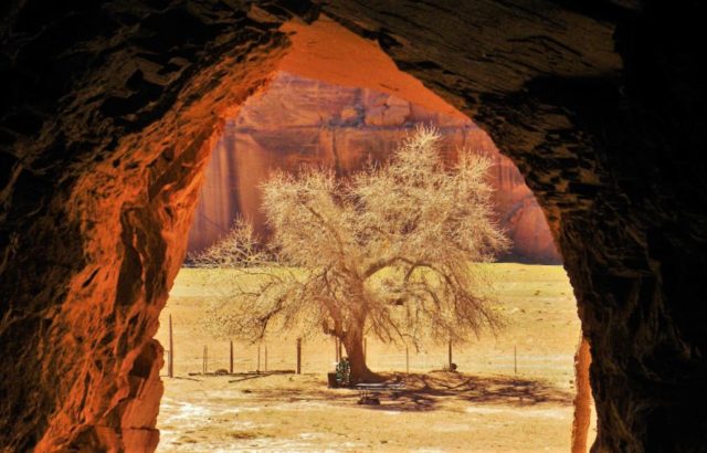
©2012 John Wanserski for Creative Juice LLCCanyon de Chelly National Monument
Map of Canyon de Chelly National Monument
Canyon de Chelly National Monument (Wikipedia entry)
Reviews of White House Ruins Trail
Hike Arizona description of White House Ruins trail
Weather forecast for Chinle, Arizona vicinity
Blog entries for Canyon de Chelly National Monument
-
Kaleidoscope Image of Tunnel on White House Ruins Trail, Canyon de Chelly National Monument – Chinle, Arizona

©2018 John Wanserski for Creative Juice LLC
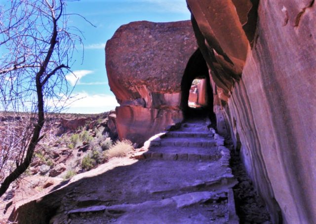
©2012 John Wanserski for Creative Juice LLCCanyon de Chelly National Monument
Map of Canyon de Chelly National Monument
Canyon de Chelly National Monument (Wikipedia entry)
Reviews of White House Ruins Trail
Hike Arizona description of White House Ruins trail
Weather forecast for Chinle, Arizona vicinity
Blog entries for Canyon de Chelly National Monument
-
Kaleidoscope Image of Butte on White House Ruins Trail, Canyon de Chelly National Monument – Chinle, Arizona

©2018 John Wanserski for Creative Juice LLC
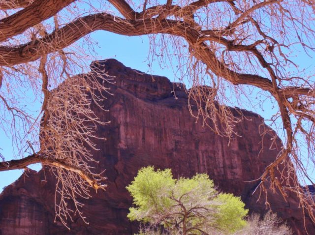
©2012 John Wanserski for Creative Juice LLCCanyon de Chelly National Monument
Map of Canyon de Chelly National Monument
Canyon de Chelly National Monument (Wikipedia entry)
Reviews of White House Ruins Trail
Hike Arizona description of White House Ruins trail
Weather forecast for Chinle, Arizona vicinity
Blog entries for Canyon de Chelly National Monument
-
Kaleidoscope Image of Pool on Intermittent Stream in Bear Canyon, Coronado National Forest – Tucson, Arizona

©2018 John Wanserski for Creative Juice LLC

©2011 John Wanserski for Creative Juice LLCBlog entries for Sabino Canyon
Blog entries for Phone Line Trail
Weather forecast for Tucson, Arizona vicinity
-
Kaleidoscope Image of Trail Through the Trees, Capital Springs State Recreation Area – Madison, Wisconsin

©2018 John Wanserski for Creative Juice LLC
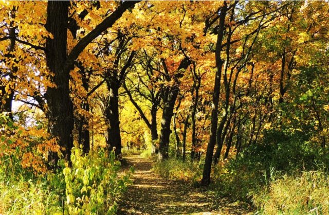
©2018 John Wanserski for Creative Juice LLCCapital Springs State Recreation Area
Map of Lake Farm Unit, Capital Springs State Recreation Area (PDF file)
Weather forecast for the Madison vicinity
Blog entries for the Capital Springs State Recreation Area
-
Kaleidoscope Image of Snowfall on the Linda Vista Trail, Pusch Ridge Wilderness – Tucson, AZ

©2018 John Wanserski for Creative Juice LLC
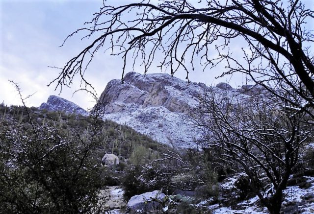
©2018 John Wanserski for Creative Juice LLCMaps of Catalina State Park (PDF file)
Weather forecast for Tucson, Arizona vicinity
Blog entries for Pusch Ridge Wilderness
-
Kaleidoscope Image of Wildflowers on the Dry Lake Trail, Chippewa Moraine State Recreation Area – New Auburn, WI

©2018 John Wanserski for Creative Juice LLC
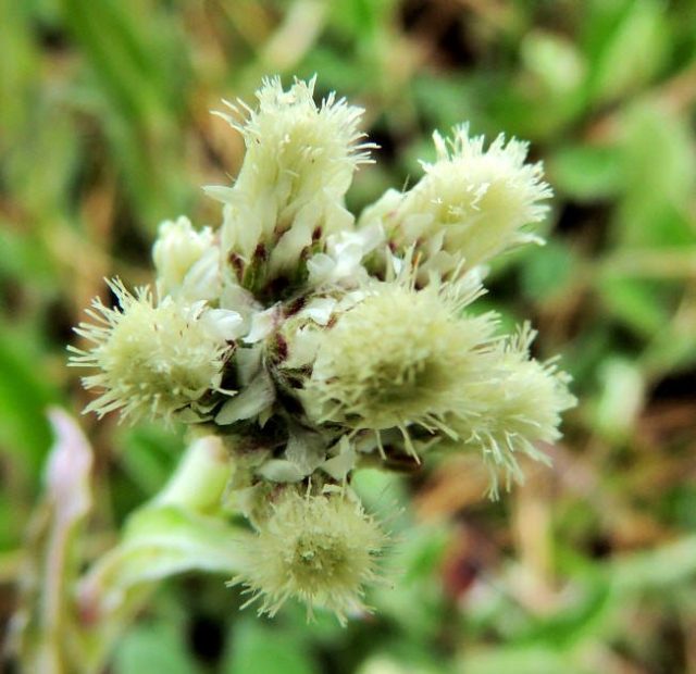
©2015 John Wanserski for Creative Juice LLCChippewa Moraine Ice Age State Recreation Area
Chippewa Moraine Ice Age State Recreation Area map
Ice Age National Scenic Trail outdoor activities
Blog entries for the Dry Lake Trail
Blog entries for Chippewa Moraine Ice Age State Recreation Area
Blog entries for Chippewa County Forest
Weather forecast for New Auburn, Wisconsin vicinity
-
Kaleidoscope Image of White Wildflower on the Phone Line Trail, Sabino Canyon – Tucson, AZ

©2018 John Wanserski for Creative Juice LLC
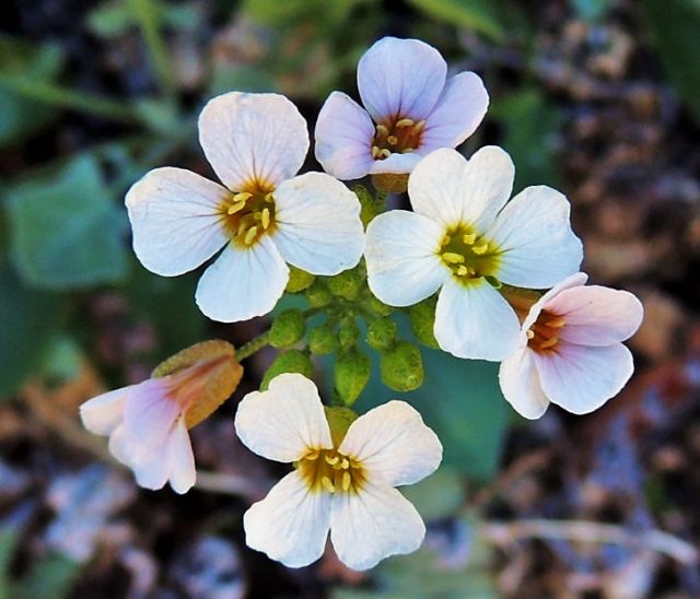
©2018 John Wanserski for Creative Juice LLCSoutheastern Arizona Wildflowers and Plants of the Sonoran Desert
Blog entries for Sabino Canyon
Blog entries for Phone Line Trail
Weather forecast for Tucson, Arizona vicinity