-
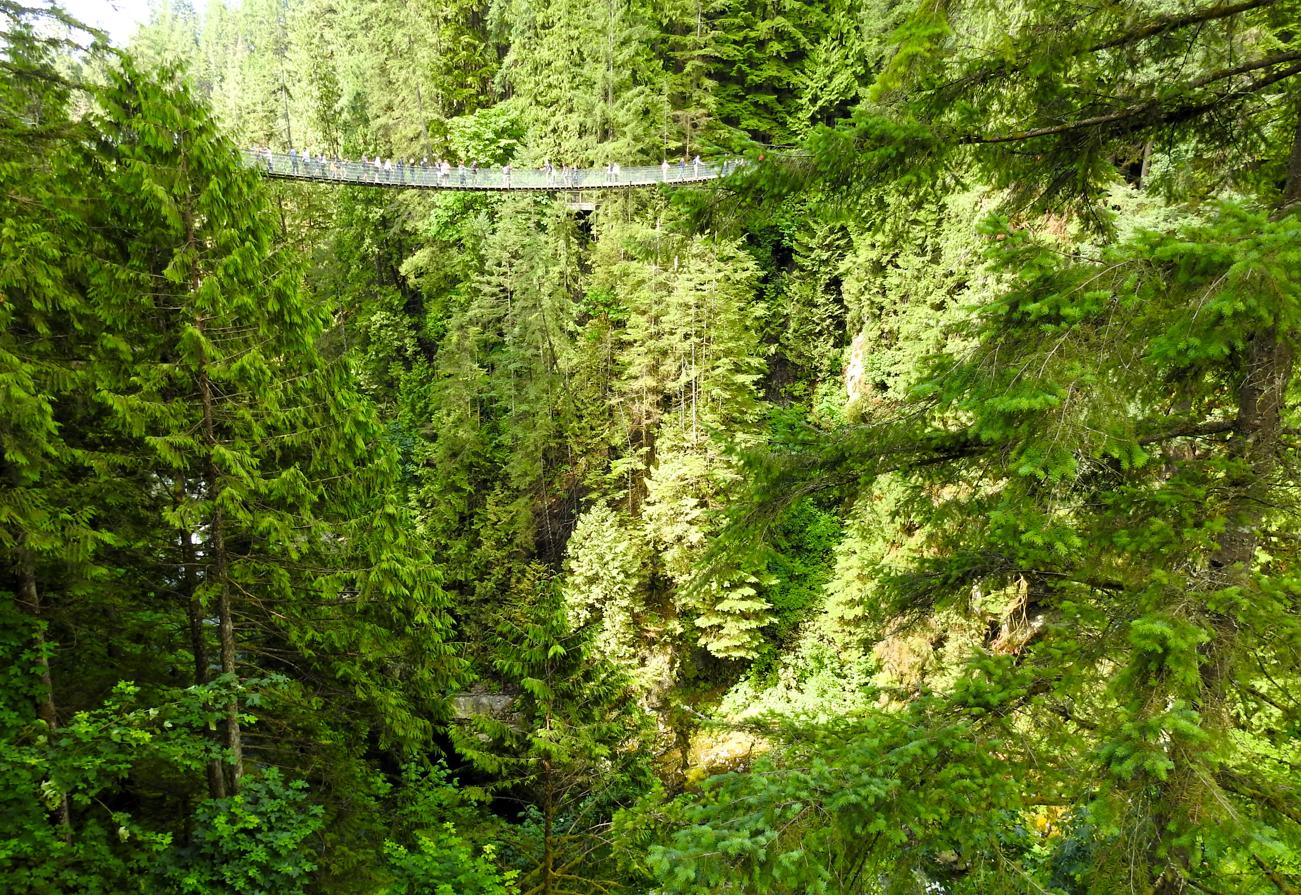
Capilano Bridge Viewed from the Cliffwalk, Capilano Suspension Bridge Park – Vancouver, Canada
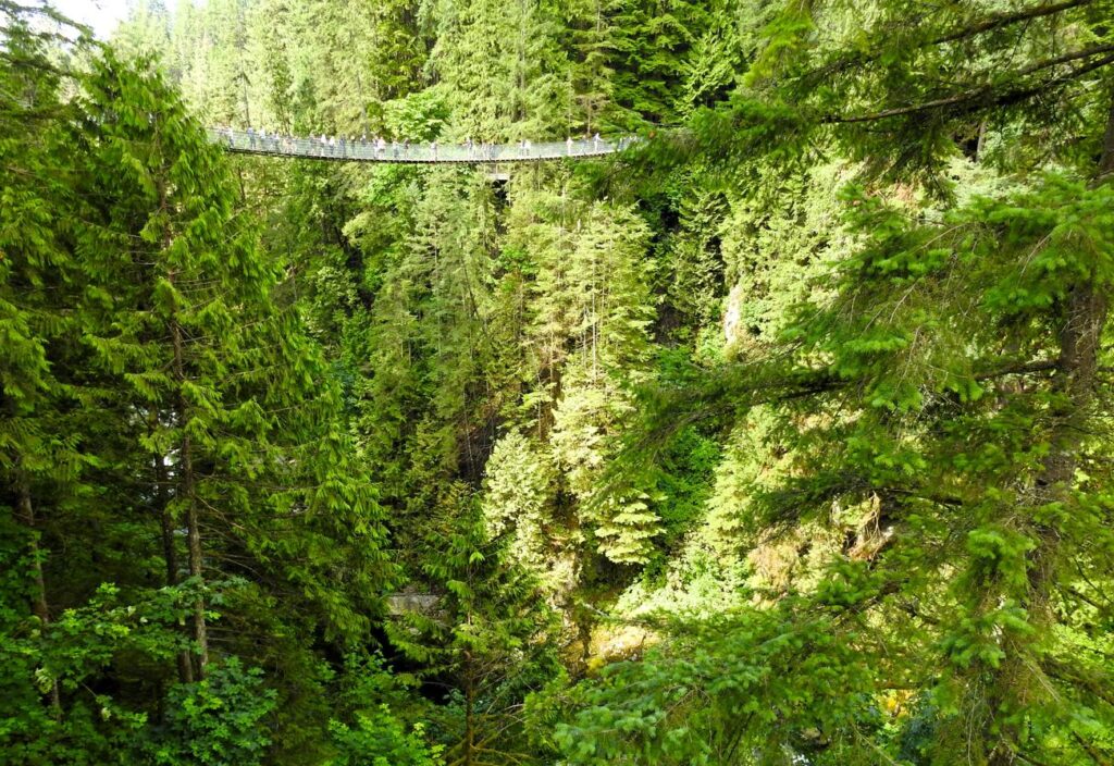
©2026 John Wanserski for Creative Juice LLC
Capilano Suspension Bridge Park
Cliffwalk at Capilano Suspension Bridge Park
Vancouver, Canada (Wikipedia entry)
Weather forecast for the Vancouver, Canada area
Blog entries for the Cliffwalk at Capilano Suspension Bridge Park
Blog entries for Capilano Suspension Bridge Park
-
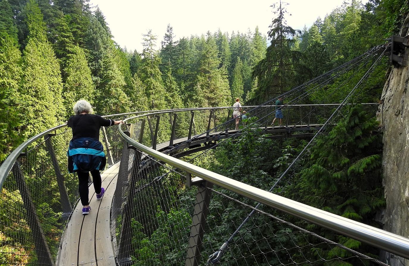
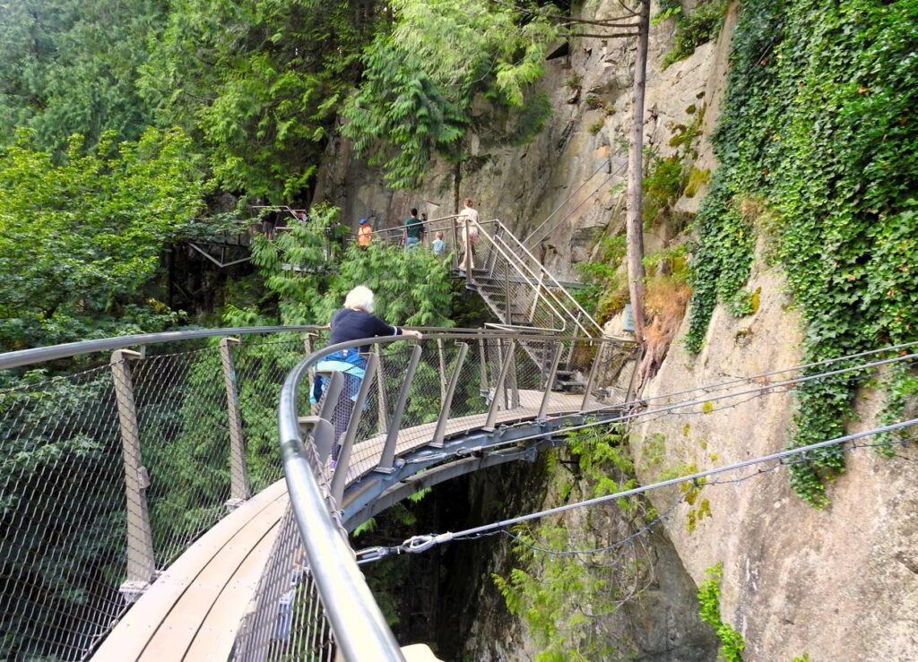
Curved Cliffwalk, Capilano Suspension Bridge Park – Vancouver, Canada
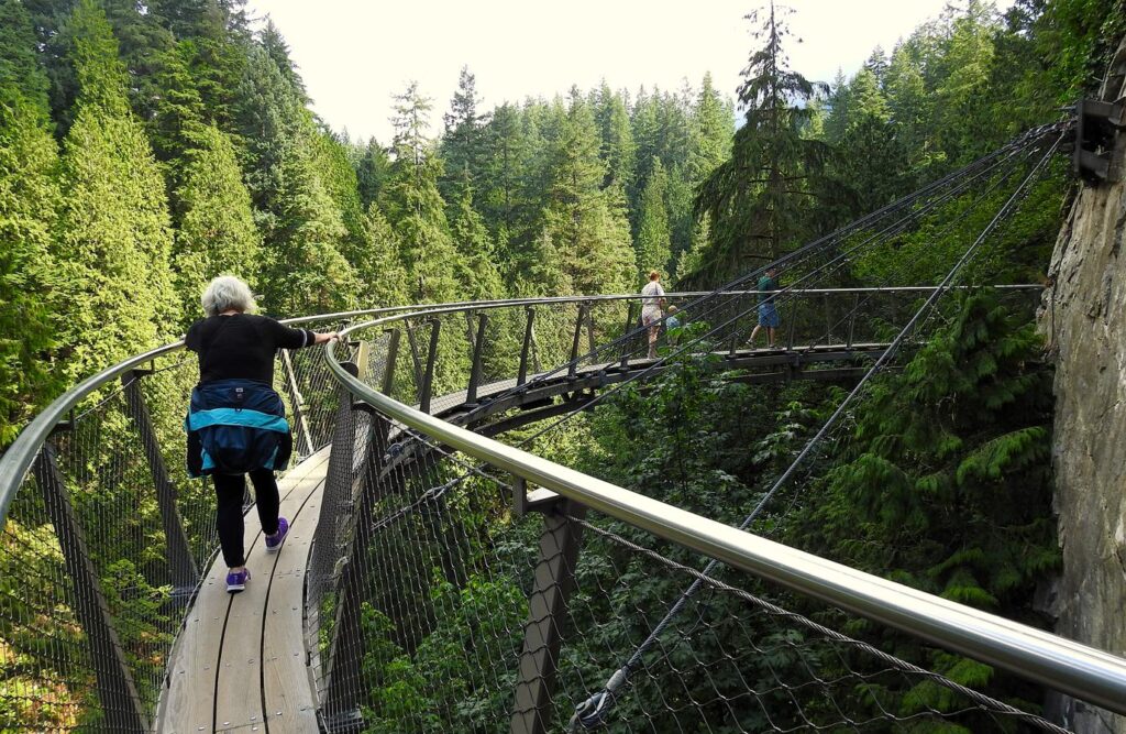
©2026 John Wanserski for Creative Juice LLC
Capilano Suspension Bridge Park
Cliffwalk at Capilano Suspension Bridge Park
Vancouver, Canada (Wikipedia entry)
Weather forecast for the Vancouver, Canada area
Blog entries for the Cliffwalk at Capilano Suspension Bridge Park
Blog entries for Capilano Suspension Bridge Park
-
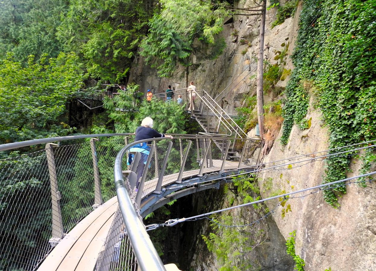
Stairway at End of Cliffwalk, Capilano Suspension Bridge Park – Vancouver, Canada
©2026 John Wanserski for Creative Juice LLC
Capilano Suspension Bridge Park
Cliffwalk at Capilano Suspension Bridge Park
Vancouver, Canada (Wikipedia entry)
Weather forecast for the Vancouver, Canada area
Blog entries for the Cliffwalk at Capilano Suspension Bridge Park
Blog entries for Capilano Suspension Bridge Park
-
Part of the Cliffwalk, Capilano Suspension Bridge Park – Vancouver, Canada

©2026 John Wanserski for Creative Juice LLC
Capilano Suspension Bridge Park
Cliffwalk at Capilano Suspension Bridge Park
Vancouver, Canada (Wikipedia entry)
Weather forecast for the Vancouver, Canada area
Blog entries for the Cliffwalk at Capilano Suspension Bridge Park
Blog entries for Capilano Suspension Bridge Park
-
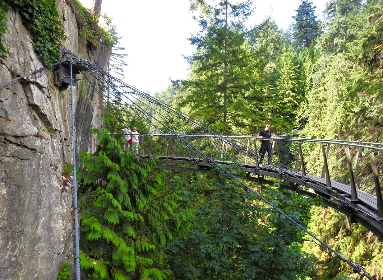
Cliffwalk Bolted to the Rock, Capilano Suspension Bridge Park – Vancouver, Canada
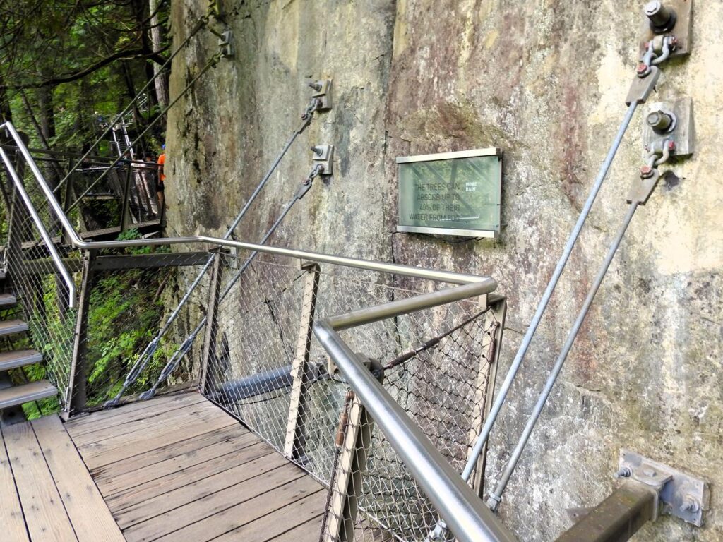
©2026 John Wanserski for Creative Juice LLC
Capilano Suspension Bridge Park
Cliffwalk at Capilano Suspension Bridge Park
Vancouver, Canada (Wikipedia entry)
Weather forecast for the Vancouver, Canada area
Blog entries for the Cliffwalk at Capilano Suspension Bridge Park
Blog entries for Capilano Suspension Bridge Park
-
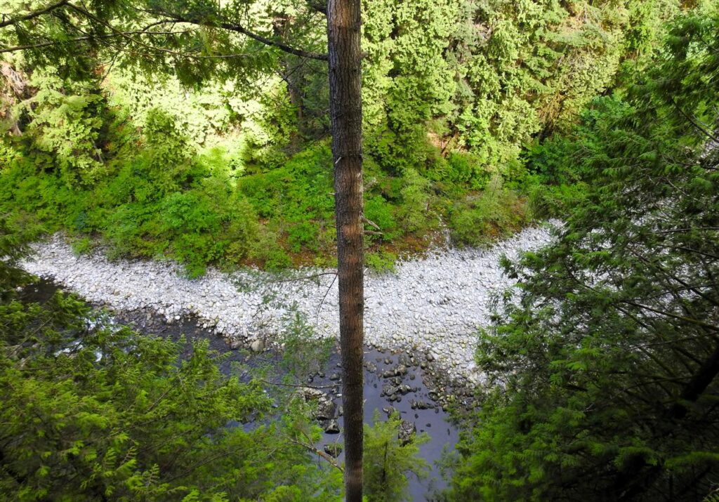
Capilano River Below the Edge of the Cliffwalk, Capilano Suspension Bridge Park – Vancouver, Canada

©2026 John Wanserski for Creative Juice LLC
Capilano Suspension Bridge Park
Cliffwalk at Capilano Suspension Bridge Park
Vancouver, Canada (Wikipedia entry)
Weather forecast for the Vancouver, Canada area
Blog entries for the Cliffwalk at Capilano Suspension Bridge Park
Blog entries for Capilano Suspension Bridge Park
-
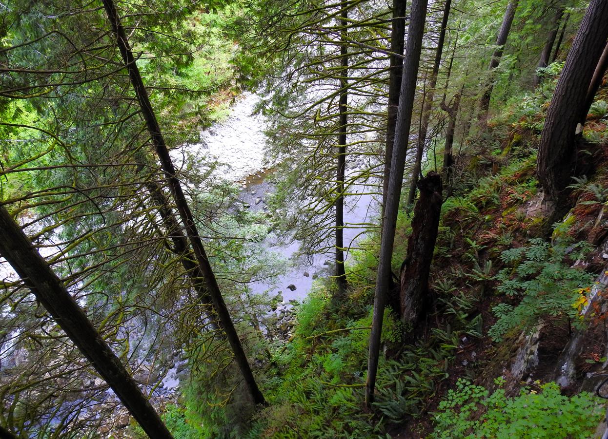
Capilano River Through the Trees, Capilano Suspension Bridge Park – Vancouver, Canada

©2025 John Wanserski for Creative Juice LLC
Capilano Suspension Bridge Park
Cliffwalk at Capilano Suspension Bridge Park
Vancouver, Canada (Wikipedia entry)
Weather forecast for the Vancouver, Canada area
Blog entries for the Cliffwalk at Capilano Suspension Bridge Park
Blog entries for Capilano Suspension Bridge Park
-
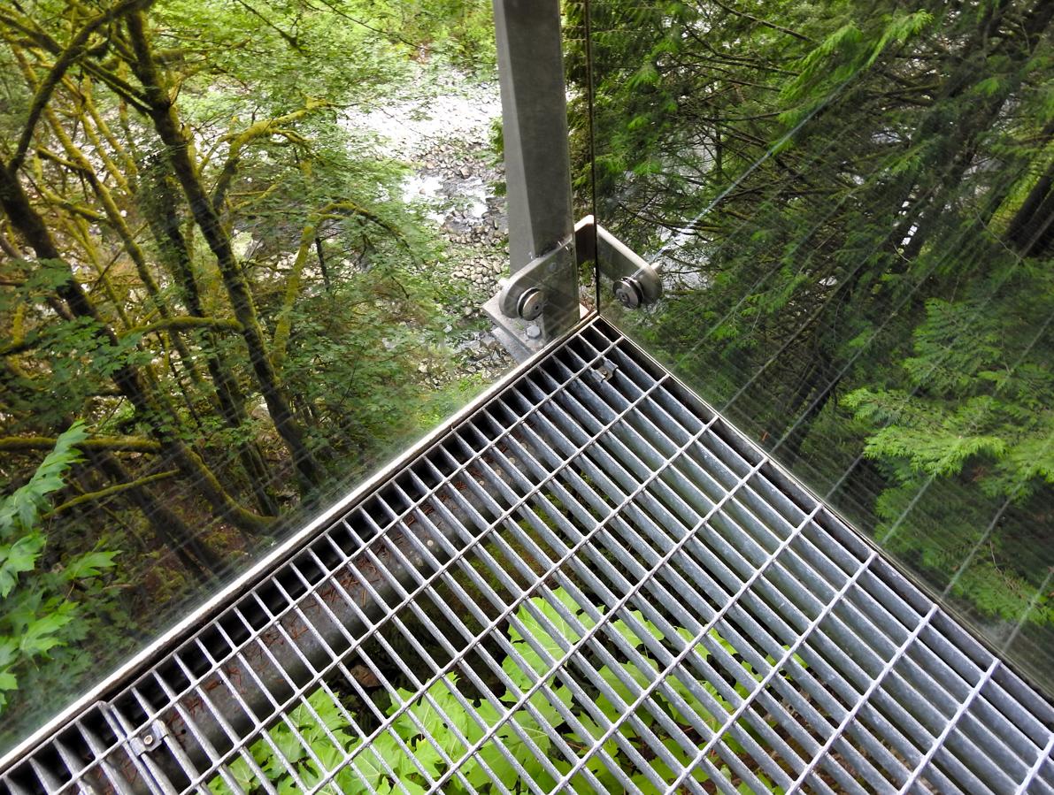
Capilano River from the Cliffwalk, Capilano Suspension Bridge Park – Vancouver, Canada
©2025 John Wanserski for Creative Juice LLC
Capilano Suspension Bridge Park
Cliffwalk at Capilano Suspension Bridge Park
Vancouver, Canada (Wikipedia entry)
Weather forecast for the Vancouver, Canada area
Blog entries for the Cliffwalk at Capilano Suspension Bridge Park
Blog entries for Capilano Suspension Bridge Park